Two-Dimensional In-Field Experiments (SMU-in-Taos): Two drones are outfitted with two North-facing, vertically-polarized antennas (2.5 GHz) on the receiver (center of bottom left) and transmtter. The antenna's radiation pattern with and without the drone is shown on the top right.


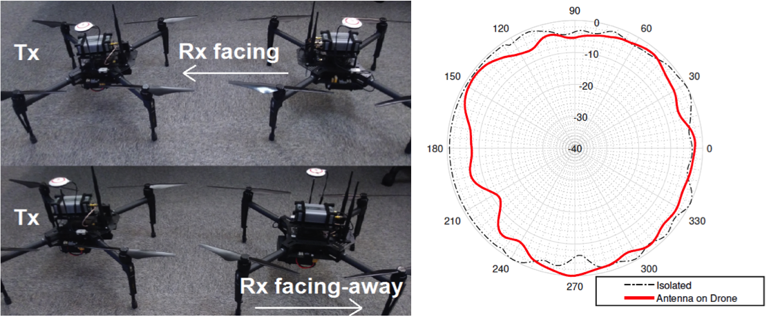
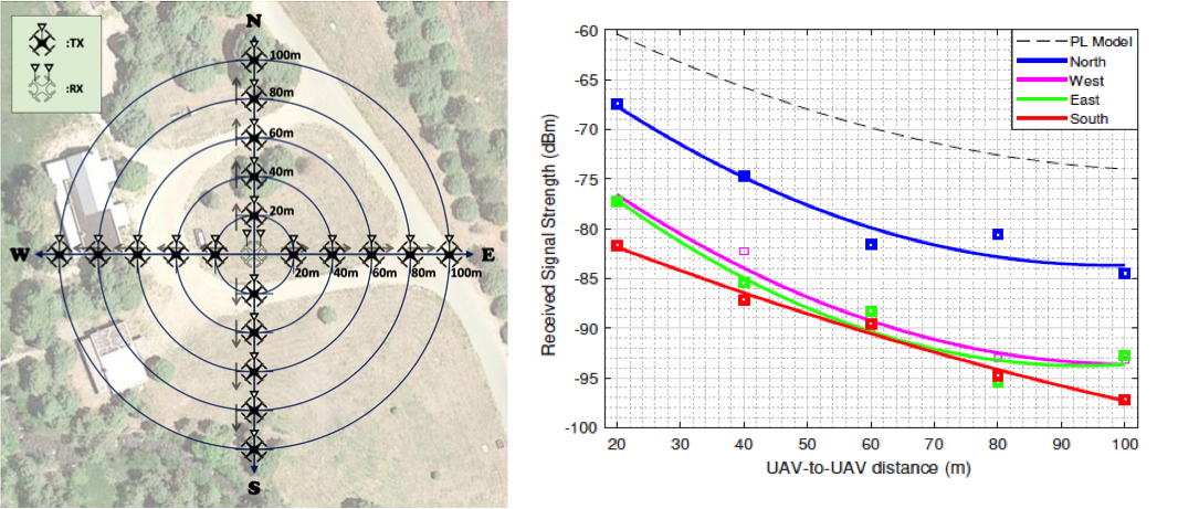
Both drones are hovering at an altitude of 60 meters. The results (bottom right) show that when the transmitter is located North (transmitter body in between), there is actually less of an affect than the three other cardinal directions. However, in all cases and despite the line-of-sight present between the drones, there is a significant loss due to the antenna being mounted on the drone.
Data files (right-click, save): https://s2.smu.edu/muddi/2D.zip. The data is stored by USRP as .dat complex 64 (I: float 32, Q: float 32) as the in-phase and quadrature components. If converted to a .csv file, the first row is the I and the second is the Q, third is I and fourth is Q, and so on. Every measurement is a voltage reading (envelope of the signal), which is processed to get the instantaneous power.
This material is based upon work supported by the National Science Foundation under Grant No. 1823304. Any opinions, findings, and conclusions or recommendations expressed in this material are those of the author(s) and do not necessarily reflect the views of the National Science Foundation.